At Roaring Fork Engineering, we are your trusted specialists for civil engineering in Glenwood Springs, Colorado. We bring expertise in civil, environmental, water resources and construction administration. We are dedicated to delivering top-tier work that, while may not always be visible, is always impactful.
For over ten years, we’ve proudly served Glenwood Springs from our Carbondale base. Our team, residing in these communities, has left a mark on landmarks like the Red Hill Recreation Area and Carbondale Marketplace. We’re not just engineers, we’re community builders shaping the places we call home.
ABOUT US
Glenwood Springs’ #1 Choice for Civil Engineers
At Roaring Fork Engineering, we are your trusted specialists for civil engineering in Glenwood Springs, Colorado. We bring expertise in civil, environmental, water resources and construction administration. We are dedicated to delivering top-tier work that, while may not always be visible, is always impactful.
For over ten years, we’ve proudly served Glenwood Springs from our Carbondale base. Our team, residing in these communities, has left a mark on landmarks like the Red Hill Recreation Area and Carbondale Marketplace. We’re not just engineers, we’re community builders shaping the places we call home.
"Roaring Fork Engineering has been serving our sanitation district for years now and we’ve always been pleased with their responsiveness and professionalism. I’d recommend them to anyone who is looking for a civil engineer."
– Ian Quillan, District Manager of Basalt Sanitation District
What We Do
As a comprehensive provider of engineering services, our capabilities extend to civil engineering, environmental engineering, water resource management, and construction administration.
We undertake an expansive range of projects, from executing detailed water and sewer rate studies to crafting effective retention systems. Our skill set also encompasses hydrological modeling, stormwater management, and integrated site design, along with proficient utility layout mapping.
Rely on us to infuse every project with our enthusiasm and expertise, providing solutions that are both innovative and efficient.
“Roaring Fork Engineering has been serving our sanitation district for years now and we’ve always been pleased with their responsiveness and professionalism. I’d recommend them to anyone who is looking for a civil engineer.”
– Ian Quillan, District Manager of Basalt Sanitation District
WHAT WE DO
As a comprehensive provider of engineering services, our capabilities extend to civil engineering, environmental engineering, water resource management, and construction administration.
We undertake an expansive range of projects, from executing detailed water and sewer rate studies to crafting effective retention systems. Our skill set also encompasses hydrological modeling, stormwater management, and integrated site design, along with proficient utility layout mapping.
Rely on us to infuse every project with our enthusiasm and expertise, providing solutions that are both innovative and efficient.
Operating from our hub in Carbondale, a stone’s throw away from Glenwood Springs, Colorado, we are the heartbeat of engineering excellence that pulses through Colorado’s mountain communities.
Our services extend to a wide range of clients, including land developers, municipal bodies, and commercial as well as private landowners. We take immense pride in enhancing both the aesthetic and practical aspects of the state we hold dear.
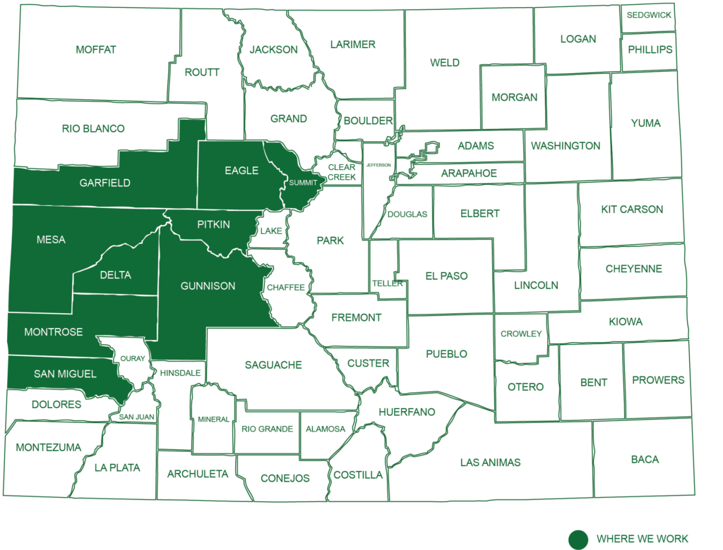
Nestled in the heart of Carbondale, Colorado, our headquarters serves as the epicenter of our operations. Our extensive work portfolio reaches across the Western Slope, serving clients from Grand Junction to Glenwood Springs, Aspen, Breckenridge, and beyond.
We cater to a diverse clientele, including land developers, municipalities, and both commercial and private landowners. Our commitment to excellence is as enduring as the mountains we work within, and we are proud to contribute to the beauty and functionality of our beloved state.