Glenwood Springs's #1 Choice for Land Surveyors
Roaring Fork Engineering is an elite land surveying and civil engineering firm based in Carbondale, CO. We serve the Roaring Fork Valley and Colorado’s mountain communities with top-notch land surveying services.
Our team of experienced professionals is ready to help you with your land development and management needs. As a leading engineering firm in the area, we are committed to delivering precise, reliable, and efficient surveying solutions that meet the highest industry standards.
Since 2012, we’ve been proud to provide the unique expertise needed to innovate solutions for Colorado’s Western Slope and its challenging terrain. Our Colorado surveyors are ready to serve you, from simple boundary surveys to subdivision mapping and beyond. Contact us today to discuss your project and receive a free, no-obligation quote.
Roaring Fork Engineering provides comprehensive civil engineering solutions across Colorado. Alongside our land surveying services, we also offer dedicated civil engineering services to plan your development and expert water engineering to promote your water management and provide solutions.
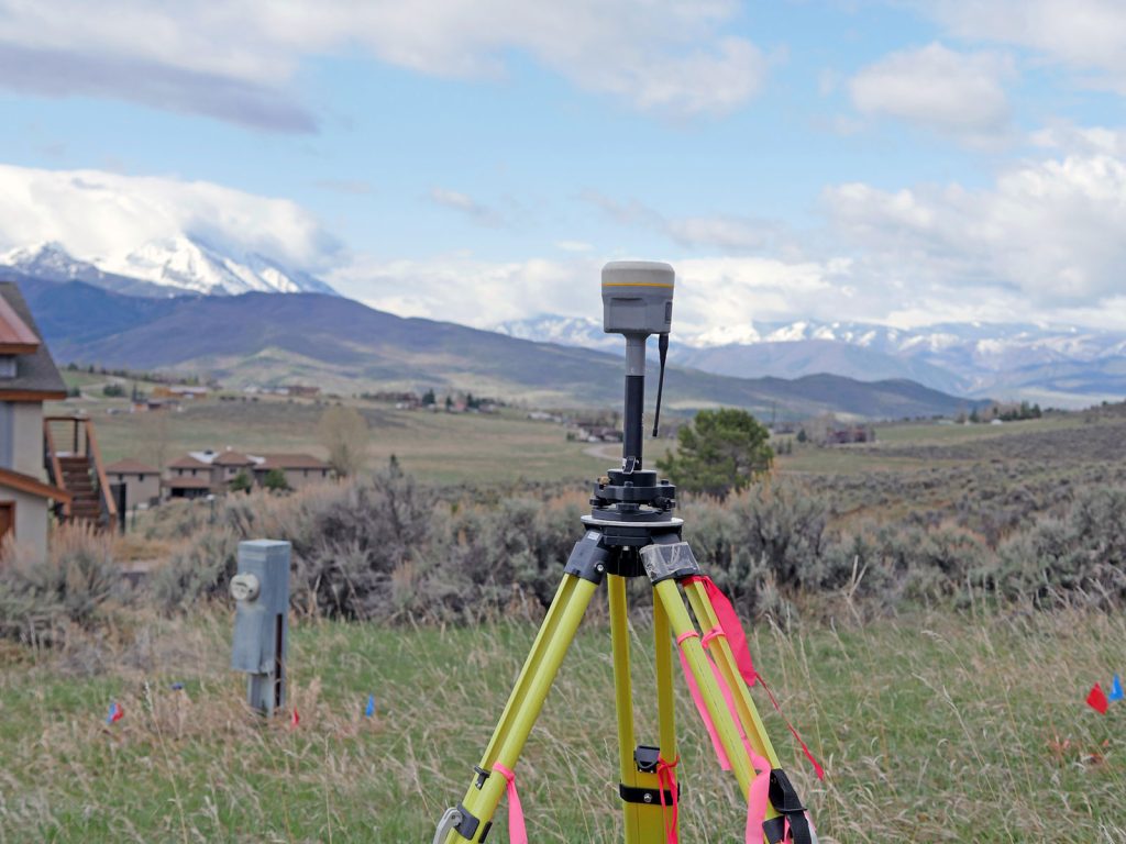
Boundary Surveys
We accurately determine and mark property lines to help you avoid disputes, encroachments, and other legal issues.
Topographic Surveys
Our expert team conducts detailed analysis of your land’s terrain, including elevations, contours, and natural features, to provide essential data for project planning and design.
Construction Staking
We offer precise staking services to ensure your construction projects are aligned with approved plans and meet all regulatory requirements.
ALTA/NSPS Land Title Surveys
Our certified land surveyors provide comprehensive ALTA/NSPS Land Title Surveys to help you make informed decisions about property transactions and development.
Subdivision Mapping
We assist in the design and preparation of subdivision maps, ensuring they comply with local and state regulations, and facilitate a smooth approval process.
Easements & Right-of-Way Surveys
We identify and document existing easements and right-of-ways on your property to protect your interests and avoid potential conflicts.
Floodplain Mapping & Analysis
Our team of experts assesses flood risks and provides accurate floodplain mapping to support responsible land development and management.
Our extensive range of land surveying services includes:
When you partner with Roaring Fork Engineering, you can expect…
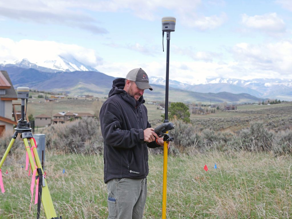
Our team of licensed land surveyors brings years of experience and knowledge to every project, ensuring accurate and reliable results.
We utilize cutting-edge surveying equipment and software to deliver high-quality data and precise measurements.
We understand that every project is unique, so we tailor our services to meet your specific needs and requirements.
We offer cost-effective surveying solutions without compromising on quality, accuracy, or efficiency.
Our dedicated team is always available to answer your questions, address your concerns, and provide timely updates on your project’s progress.
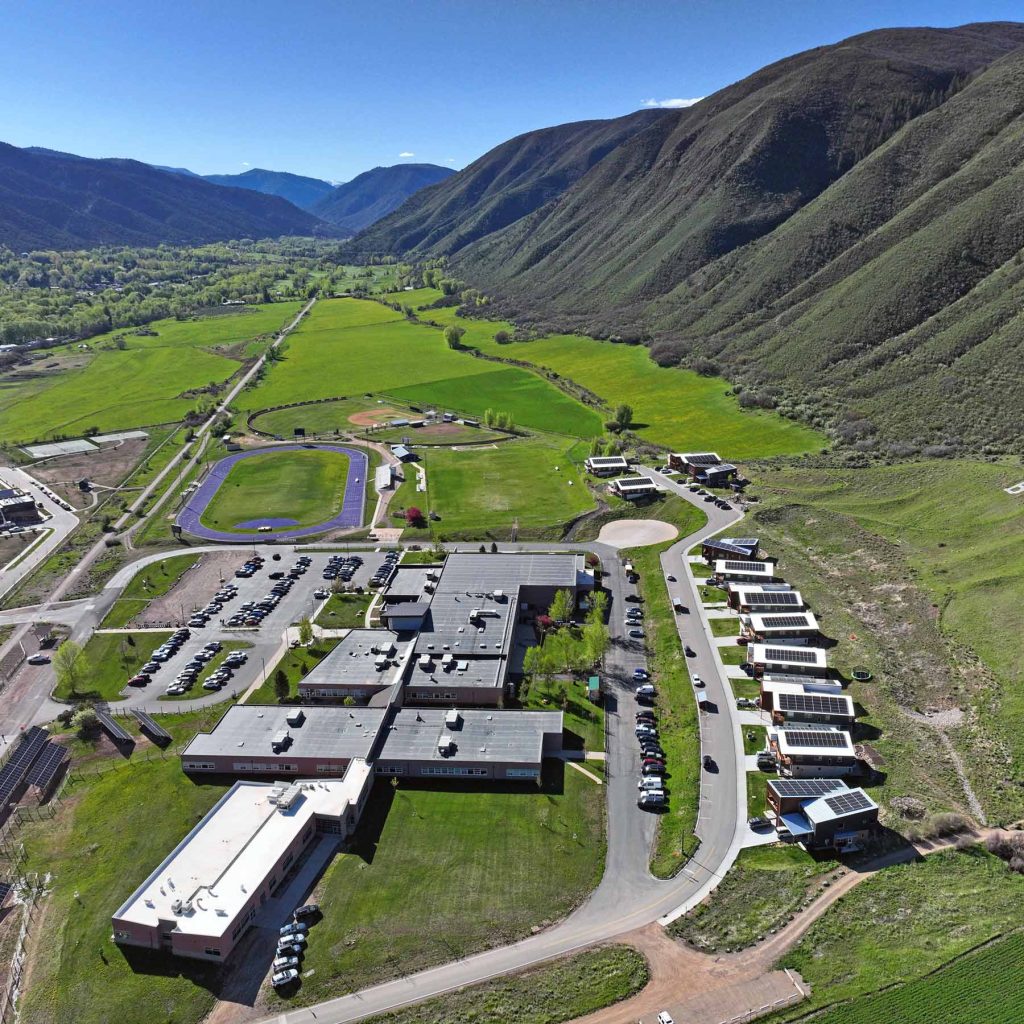
We serve a variety of residential and commercial clients to meet their land surveyor needs in Colorado.
Commercial
Are you closing on a commercial property, or adding improvements? Our Colorado surveyors are equipped to identify which surveys you need and execute them with the utmost attention to detail, ensuring you have all the information for your projects.
Power up your informed decision-making with our suite of commercial land survey services, from topographic surveys to ALTA/NSPS Land Title Surveys.
Residential
Whether you’re closing on a new home or planning additions to your current home, our residential surveyors will identify the information you need to know and coordinate the necessary surveys for your home.
Get clear, accurate property measurements and boundary marking with our residential land survey services.
We serve a variety of residential and commercial clients to meet their land surveyor needs in Colorado.
Are you closing on a commercial property, or adding improvements? Our Colorado surveyors are equipped to identify which surveys you need and execute them with the utmost attention to detail, ensuring you have all the information for your projects.
Power up your informed decision-making with our suite of commercial land survey services, from topographic surveys to ALTA/NSPS Land Title Surveys.
Whether you’re closing on a new home or planning additions to your current home, our residential surveyors will identify the information you need to know and coordinate the necessary surveys for your home.
Get clear, accurate property measurements and boundary marking with our residential land survey services.
As a locally-owned business, we understand the nuances of land surveying for different neighborhoods. Discover how we serve your community specifically today.
As a locally-owned business, we understand the nuances of land surveying for different neighborhoods. Discover how we serve your community specifically today.
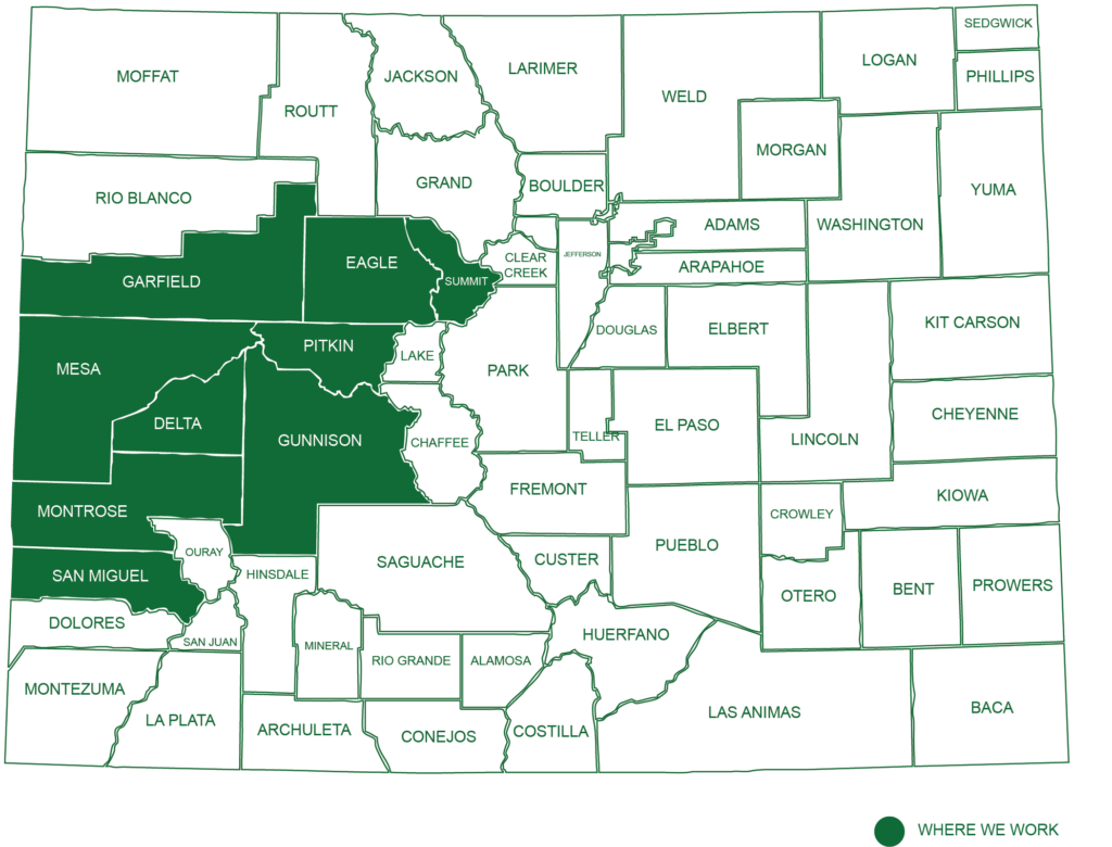
Our office is located in Carbondale, Colorado, but you can find our work throughout the Roaring Fork Valley and Colorado’s mountain communities. Our service area covers Garfield County, Mesa County, Eagle County, Summit County, Pitkin County, Gunnison County, Delta County, Montrose County and San Miguel County.
If you’re in need of professional land surveying services in Colorado, look no further than Roaring Fork Engineering. Let us help you navigate the complexities of land development and management with our comprehensive solutions and expert guidance.
Want to know more about us? Meet our team today.
“I have worked with Roaring Fork Engineering for many years and they are very prompt and professional. A great team to work with.”
– April T.
Nestled in the heart of Carbondale, Colorado, our headquarters serves as the epicenter of our operations. Our extensive work portfolio reaches across the Western Slope, serving clients from Grand Junction to Glenwood Springs, Aspen, Breckenridge, and beyond.
We cater to a diverse clientele, including land developers, municipalities, and both commercial and private landowners. Our commitment to excellence is as enduring as the mountains we work within, and we are proud to contribute to the beauty and functionality of our beloved state.
"I have worked with Roaring Fork Engineering for many years and they are very prompt and professional. A great team to work with."
– April T.